 |
Satellite image comparison
showing massive loss of
snow cover over Prairies
over the past 5 days |
Double digit temperatures over the past 3 days has resulted in a rapid snow loss across the Prairies, including southern MB and the Red River valley. (see satellite image comparison left) This has resulted in a rapid rise of the Red River over the weekend, which has risen
6 feet in Winnipeg (James Ave level) since Friday, putting the river walkway at the Forks under water today. River levels will continue to rise rapidly over the next little while as snowmelt makes its way into the river basin. Luckily, no significant precipitation has fallen over the past week, which has resulted in a more favourable flooding situation for the time being. The prolonged cold weather of April resulted in a slow gradual melt, which has eased a more serious flooding threat. Nonetheless, any significant precipitation that falls over the next couple of weeks could result in a renewed flood threat as the flood crest approaches from the south.
(click here for graph of Red River water levels in Winnipeg compared to other peak years - note: not always up to date)
18.78 feet RED RIVER WATER LEVEL: (
JAMES AVE, WINNIPEG)
@ 3:46 pm May 1
 |
Forks river walkway goes under water
April 28 2013
I was walking on this trail
just 24 hours earlier |
As for precipitation chances in the short term, a clipper system from Saskatchewan Monday will spread an area of showers over southern MB and the Red River valley by afternoon and evening, with general amounts of 5-10 mm expected. Some of the showers could produce locally heavy downpours Monday evening with 10-20 mm possible in some localities, and even the chance of the season's first thunderstorms. Colder weather will follow in the wake of this system for Tuesday, with even some accumulating snow possible through western MB parklands and Interlake regions Monday night into Tuesday. Some of that snow may work its way into the Red River valley Tuesday night, ushering in a cold start to May with temperatures well below normal. A moderating trend is expected by the weekend with temperature returning to more seasonal values.
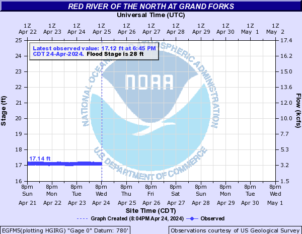 |
Red River flood forecast for
Grand Forks ND (NWS) |
Red River flood forecasts (NWS)


The weirdest thing about it being about the winter that just ended is not all the snow or the cold cold temperatures its the contrast between the winter winter that (hopefully) just ended and last years miraculous warm winter and early spring
ReplyDeleteRob, is Wpg officially snow free now? Would it be the latest date ever recorded?
ReplyDeleteAlso, at what height at James Ave does the floodway come into use?
Yes, Winnipeg is officially snow free as of this morning. My snow on ground measurement went from 3 cm on Friday, to "trace" yesterday, to "0" this morning.
ReplyDeleteThe airport auto snowdepth sensor went from 12 cm on the 23rd to nothing on the 24th. Not sure if the snowcover did indeed go to zero, or it just stopped reporting.
Latest loss of snowcover at the airport was April 26th 1997 (records from 1955-2004) so this was one of the latest melts on record this year.
As for the when the floodway opens, I'm not sure at what level that occurs.
Rob, that's James St. for the Red river level, not St. James, which is on the Assiniboine.
ReplyDeleteThanks for the correction JoeL... Post has been updated.
ReplyDeleteBy the way, Red is up to 16.8 ft at James St this morning, up almost 6 feet from yesterday morning.
I got 14.42 feet at James AVE as of 8:50am on the RED river. I think your blog post is quoting Assiniboine @ St. James STREET.
ReplyDelete>>Anonymous said... I got 14.42 feet at James AVE as of 8:50am on the RED river. I think your blog post is quoting Assiniboine @ St. James STREET.
ReplyDeleteOh my.. you're absolutely right. Sorry for the mix up. You're correct.. I was inadvertently quoting St James on the Assiniboine. Blog has been updated with the correct James St level for the Red.. 14.45 feet as of 8:56 am, up 3.5 feet since yesterday morning, not 6. Thanks for the correction..
Wow...it just keeps getting uglier and uglier for Wednesday and even tomorrow. A high of -3 on May 1st.....yikes.
ReplyDeleteBand of showers over western MB will be pushing east today reaching RRV this afternoon with some minor amounts forecast as it goes through.. perhaps a couple of mm. Then this evening, another batch of convection is forecast to develop over North Dakota and spread northeast, affecting southern RRV and SE MB with heavier rainfall.. perhaps 10-20 mm. NAM has heaviest precip mainly SE of Winnipeg with 5-10 mm for us, but Euro and GEM bring in a good 15 mm for Winnipeg tonight.. so we'll have to keep an eye on that secondary area of convection and see how it develops. HPC noting a maximum of 25 mm over the Grand Forks area. Whatever the case, looks more likely that parts of the RRV will see some locally heavy rain tonight.
ReplyDeleteThankfully, looks like heaviest snow will be staying north of Winnipeg tonight into Tuesday, and there could be some hefty totals up through western MB and central/northern Interlake regions. GEM is going crazy with the snow amounts, probably overdone due to convection, but perhaps 20 cm possible in some areas by Tuesday evening? Even Winnipeg will likely see some snow Tuesday afternoon/night, but hopefully mostly wet stuff that melts. Winter refuses to give up without a fight this year..
ReplyDeleteRob, do you think those ugly forecasted temps for Wednesday and Thursday are too cold or realistic in this case?
ReplyDeleteJust went past Sturgeon Creek, and it's already flooding a bit. Raining now.
ReplyDeleteWonder when was the last time we had our first measurable rain of the YEAR just a couple days before the start of May! It's been too long.
ReplyDeleteSo THAT'S what those strange liquid drops are falling from the sky! :)
ReplyDeleteConnor.. I drove by Sturgeon Creek this afternoon as well.. not only is it flooding, but it's flowing very rapidly too. Stay away kids!
So is April going to be the coldest April ever??
DeleteIs there a chance that we could be seeing a few rumbles of thunder and or a light thunderstorm tonight in the Winnipeg region? The NWS is mentioning scattered showers and thunderstorms south of the border & convection firing up from 10pm to 1am. Spotwx NAM is also showing some instability in areas in and around Winnipeg. What do you think? Thank's- Mike....
ReplyDeleteMike.. It's possible there could be a stray thunderstorm coming through RRV overnight, but they'll be isolated in nature, and a better south of Winnipeg. Note that some thunderstorms have fired up in southern SK this afternoon, and one cell even went severe for a few scans with large hail likely. That area of convection will be pushing into SW MB this evening, but likely weakening into the night.
ReplyDeleteRe: coldest April ever..
ReplyDeleteWe were on pace for coldest April ever up to the 25th, before our "warm spell" (actually near normal!)
Looks like we'll end up tied with 1907 for 3rd coldest at -2.1C, or drop to 4th coldest at -2.0C. Either way, this will be the coldest April in Winnipeg in over a century.
Rob, I've noticed that there are no indications of a significant warmup through the first 10 days of May or so which would likely mean some below average temps once again.
ReplyDeleteCould we be heading into yet another cold May and 8th consecutive month below normal?
Anonymous.. I certainly hope we're not heading for yet another below normal month, but it wouldn't surprise me. Statistically for Winnipeg, the odds of a cooler than normal May following a cold April are about 60%, compared to 35% chance of an above normal May (based on the top 20 coldest Aprils).
ReplyDeleteBut frankly, it's been too tough to try to predict long range outlooks this spring. I'm going to concentrate on the next week or so, and leave the rest to hopeful wishing..
Got 22.4 mm of rainfall here in River Park South since yesterday afternoon.
ReplyDeleteJJ
Wow.. 22°C in Thunder Bay then 13°C in Upsala and 2°C in Winnipeg right now.
ReplyDeleteRob,
ReplyDeletehow much snow is expected tonight, everything is turning white. Will winter ever end???????????????????
Well at least we don't live in Duaphin, they are getting as much as 1 foot of snow and all we'er getting is a flurry. compared to them we have nothing to complain about.
ReplyDeleteBox134..
ReplyDeleteWinnipeg is currently getting some bands of heavier flurries coming down from the Interlake in our NW flow.. The bulk of the steadiest snow should remain to our north, so I don't think Winnipeg will see too much accumulations.. but perhaps 1-2 cm of a slushy coating.. which is still too much for April 30th. As noted, much worse to our north with 20+ cm through Dauphin/McCreary areas..
Rob, do you think those readings of 20C by Monday are too optimistic at this point or realistic?
ReplyDeleteWe will be warming up by Monday, and 20C may be reachable if we get enough sun with a SW breeze. 18C may be more realistic. Unfortunately, it looks short lived as we get into another cool shot after that.
ReplyDelete