 |
| MODIS satellite image of MB lakes Saturday Nov 8 2014 |
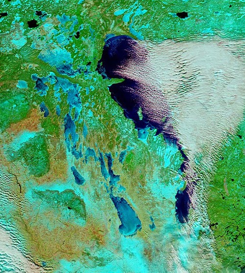 |
| MODIS satellite image of MB lakes Thursday Nov 13 2014 |
Well below freezing temperatures over the past week has brought the first snows of the season over much of southern MB as well as a rapid freeze up of the Manitoba lakes. The two "false colour" MODIS satellite images above were taken just five days apart between Nov 8th (left) and Nov 13th (right) The images show a much different landscape over southern MB over that time with more extensive snow cover (shown in light blue) and a rapid freeze up of the western MB lakes, with Lake Manitoba and Lake Winnipegosis now mainly ice covered. Lake Winnipeg still remains generally ice free except along the shores and some bays.. which is allowing lake effect cloud and flurries to persist as cold winds blow over the open water (open water seen as dark blue on satellite imagery with clouds seen in white) In fact, you can see the bands of heavier lake effect snow over the past day or two immediately south of Lake Winnipeg and Lake Manitoba, with less snow cover elsewhere over southern MB (bare land shows up as light brown)
With a continuation of well below freezing weather over the next 5 to 10 days, ice cover will continue to grow rapidly on the lakes, with Lake Winnipeg likely freezing up by the middle to end of next week. This will effectively shut off the lake effect machine for the season, and will also allow invasions of cold air to spread into southern Manitoba unmoderated by the lakes. Like it or not, winter is here folks!


