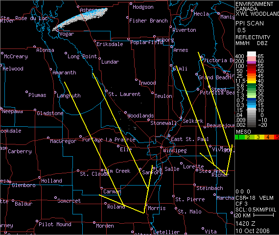
 Given 330-340 degree low level steering winds, the lake effect bands will likely set up off the south end of Lake Manitoba through Elie and Fannystelle towards Brunkild. Off Lake Winnipeg, the bands will likely set up over Grand and Patricia Beaches south-southeast towards Beausejour and Vivian. (see map) These lake effect bands could be quite intense if they change into snow as expected. Near zero visibility in heavy wet snow are likely through these bands overnight through Wednesday with local accumulations of 5-10 cm per 12 hours possible. Accumulations will be less if the precipitation is mixed with rain which may be the case close to the lakes where the 11c lake water will warm the low levels enough to maintain precipitation as rain.
The orientation of the lake effect bands will depend on the exact low level wind direction. If the low level winds are more northerly (350-360 degrees), the bands will be a little more west than the map indicates. If steering winds are more northwesterly (300-320) the bands will be further east. Note that a wind of 300 degrees can bring lake effect into Winnipeg off Lake Manitoba.
Whatever the case, looks like an interesting couple of days shaping up as Mother Nature sends us an early taste of winter!
Cold front has pushed south of Dauphin as of 11 am with gusty north winds, temperature down to 0C, and visibility of 1 km in freezing drizzle or wet snow.
ReplyDeleteRain ahead of the cold front is moving southeast and should move into Winnipeg from the northwest by 1 pm. Expect a couple of hours of cold rain with temperatures falling this afternoon as winds shift into the northwest behind the cold front. Rain may even change to wet snow before it ends by evening. Get ready!