Tuesday, April 30, 2013

Storm system brings signifficant rainfall to Red River valley, late season snowfall through western MB/Interlake regions..

Snow north of Plumas MB
near McCreary
credit: @TLCourt
An energetic storm system tracking across the northern US plains into Northwest Ontario brought significant precipitation over Southern Manitoba over the past 36 hours. Over the Red River Valley and Southeast Manitoba, precipitation fell mainly as rain with some locally heavy amounts up to 20 to 30 mm overnight into this morning. Further north.. temperatures were colder and precipitation fell mainly as snow last night through today. Significant accumulations were reported especially over Western Manitoba along the eastern slopes of the Riding mountains in the Dauphin and McCreary areas where snowfall amounts in excess of 30 cm were reported.

The following are unofficial rain and snowfall reports over the past 24 to 36 hours.
Rainfall reports over past 36 hours to 7 PM...

Winnipeg Airport ......... 19 mm
Winnipeg forks ........... 23 mm
Emerson .................. 16 mm
Pinawa ................... 29 mm
Sprague .................. 27 mm
Steinbach ................ 21 mm
Portage la Prairie ....... 15 mm
Morris ...................  8 mm
Morden ...................  7 mm
Gretna ...................  7 mm
Carman ...................  4 mm
Brandon Airport ..........  5 mm

Snowfall reports to 7 PM.. (estimates)

Dauphin ................. 20-30 cm
McCreary ................ 30-40 cm
Ste Rose Du Lac .....  35-45 cm
North of Plumas ........ 35-45 cm
Langruth ................... 35 cm 

Sunday, April 28, 2013

Red River rising rapidly as big melt continues..

Satellite image comparison
showing massive loss of
snow cover over Prairies
over the past 5 days
Double digit temperatures over the past 3 days has resulted in a rapid snow loss across the Prairies, including southern MB and the Red River valley. (see satellite image comparison left) This has resulted in a rapid rise of the Red River over the weekend, which has risen 6 feet in Winnipeg (James Ave level) since Friday, putting the river walkway at the Forks under water today. River levels will continue to rise rapidly over the next little while as snowmelt makes its way into the river basin. Luckily, no significant precipitation has fallen over the past week, which has resulted in a more favourable flooding situation for the time being. The prolonged cold weather of April resulted in a slow gradual melt, which has eased a more serious flooding threat.  Nonetheless, any significant precipitation that falls over the next couple of weeks could result in a renewed flood threat as the flood crest approaches from the south. (click here for graph of Red River water levels in Winnipeg compared to other peak years - note: not always up to date) 

18.78 feet   RED RIVER WATER LEVEL:  (JAMES AVE, WINNIPEG
@ 3:46 pm May 1
   
Forks river walkway goes under water
April 28 2013
I was walking on this trail
just 24 hours earlier  
As for precipitation chances in the short term, a clipper system from Saskatchewan Monday will spread an area of showers over southern MB and the Red River valley by afternoon and evening, with general amounts of 5-10 mm expected. Some of the showers could produce locally heavy downpours Monday evening with 10-20 mm possible in some localities, and even the chance of the season's first thunderstorms. Colder weather will follow in the wake of this system for Tuesday, with even some accumulating snow possible through western MB parklands and Interlake regions Monday night into Tuesday. Some of that snow may work its way into the Red River valley Tuesday night, ushering in a cold start to May with temperatures well below normal. A moderating trend is expected by the weekend with temperature returning to more seasonal values.

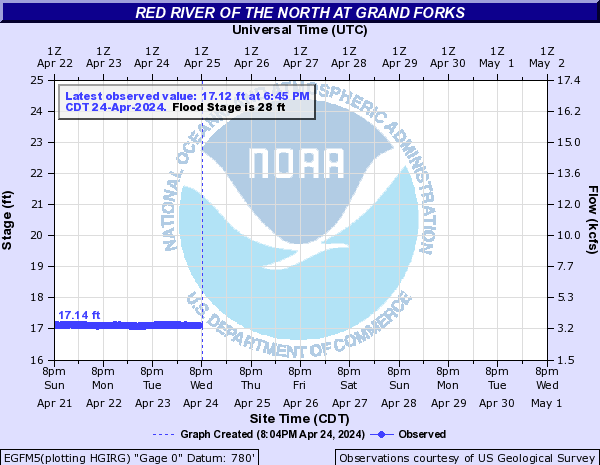
Red River flood forecast for
Grand Forks ND  (NWS)

   Red River flood forecasts (NWS)
   
   - Fargo

   - Grand Forks

   - Pembina


Monday, April 22, 2013

Major warmup expected by weekend.. rapid snow melt and river level rises likely as temperatures climb into double digits

Forecast of Red River levels - Fargo
River is expected to rise to
major flood levels by Apr 29th
(image credit - NOAA)
A long overdue warming trend appears to be on its way over southern Manitoba and much of the southern Prairies by the weekend, as a persistent cold snap finally eases its grip over the central continent. In Winnipeg and much of the eastern Prairies, temperatures have been below normal for 6 consecutive weeks, allowing an unseasonably late snowpack to persist well into the end of April, one of the latest melts in history.  After another chilly night tonight, sunny skies and a southwest wind will push temperatures close to +5C Tuesday afternoon in Winnipeg.. a mark still to be reached this year at the city airport monitoring site. A brief cooldown is expected Wednesday as a cold front pushes across southern Manitoba with some showers or flurries, before a quick return to milder conditions Thursday. The warmup really begins in earnest Friday into the weekend as temperatures climb into the double digits for the first time this year.. the latest such occurrence in over a century.  That of course will result in an accelerated snowmelt over the weekend, especially with temperatures remaining above freezing at night.  Creeks and rivers will become especially dangerous due to rapidly melting ice and snow, and authorities have cautioned residents to be extra vigilant and keep away from these dangerous bodies of water.  A brief cooldown is expected early next week before another surge of warmer air moves in for the start of May. As a result, area rivers will be experiencing rapid rises as snow and ice melts.. and in fact, flood warnings are out already for the Red River around the Fargo area, where the river is expected to rise 15 feet over the next week, reaching major flood levels of 32 feet by next Monday, with a peak approaching 40 feet later in the week.  Get ready folks.. the Red is on the rise.

North Dakota Red River flood links:

Saturday, April 20, 2013

Another burst of snow expected Sunday.. spring weather still eluding southern MB

RGEM valid mid morning
Sunday Apr 21 2013
System will push an area
of snow across southern MB
A chilly start to the day today will give way to a more pleasant afternoon as sunny skies allow temperatures to rise above the freezing mark this afternoon over the Red River valley. Still, temperatures will continue to be some 10C below normal for this time of year, with normal highs now in the +13C range. Skies will cloud over tonight ahead of the next weather system that will be tracking across southern Manitoba from Saskatchewan overnight into Sunday. An area of snow is expected to spread over Winnipeg and the RRV early Sunday, with a couple cm of slushy snow possible through early afternoon. There's a possibility that local amounts up to 5 cm are possible as a band of heavier snow moves through near midday.  This band of snow will push east of the RRV Sunday afternoon, with temperatures climbing to +3C which should melt off much of the morning snow.

Unfortunately,  the colder than normal weather pattern is expected to continue through much of the upcoming week, with daily highs only in the sub +5C range through mid week and overnight lows below freezing. This is good news on the flood front as a gradual snowmelt is exactly what is needed to minimize flood damage.  A top 3 flood event is now projected over the Red River valley with a crest expected to arrive in Emerson around mid May, and Winnipeg around the Victoria Day weekend... one of the latest crests on record.    

Monday, April 15, 2013

Another wintery blast over southern Manitoba.. 2013 poised to enter record books as latest spring in over 140 years

Conditions on Highway 15 east
of Winnipeg, Monday April 15 2013. 
Snow and strong winds led to poor
highway conditions and many accidents
(photo credit: @globalwinnipeg)
Old Man Winter refuses to ease his grip over the southern Prairies, with another wintery blast of snow and strong winds over southern Manitoba today.  The storm system, which pounded North Dakota with up to 45 cm of snow in Bismarck Sunday, swept into southern Manitoba early this morning, bringing 5-12 cm of snow to much of the Red River valley, including Winnipeg. The latest wintery blast accompanied by gusty north winds to 60 km/h produced treacherous road conditions, and led to several accidents, including one that claimed the life of a young woman in southeast Manitoba.

Snowfall totals reported today.. (COOLTAP observations from Env Canada)

Winnipeg ............... 7.8 cm
Oakbank ............... 8.6 cm
St Alphonse ........... 8.4 cm
Pinawa ................... 5.0 cm
Miami ................... 10.0 cm
Winkler ................. 12.0 cm

Snow in April in southern Manitoba is not unusual. It happens virtually every year. So today's wintery blast was not exceptional or unheard of for this time of year. But mid April snowfalls usually melt fairly quickly, leading to rapid warmups as the strengthening April sun warms up the Prairie soil.

But not this year.

90 day temperature chart
for Winnipeg to Apr 14
An unsually persistent cold weather pattern since early March has resulted in a deep and extensive snowpack over southern Manitoba lingering well into April, which has reinforced colder than normal temperatures all month. Today was the 36th consecutive day below normal in Winnipeg (March 9th was the last day above normal) and it appears that below normal temperatures will continue into next week. Incredibly, the temperature has yet to reach +5C this year at Winnipeg airport.. a mark usually reached by mid to late March. With no prospect for +5C the rest of the week, this year will mark the latest date in 141 years that Winnipeg has reached its first +5C of the year (records back to 1872)  The previous record latest date was April 15th 1950 (year of the historic Red River flood)  It should be noted that on average, Winnipeg sees at least 20 days above +5C in April.

Latest dates to hit +5C in Winnipeg (since 1872)

1.  Apr 24 2013 ...........  +5.5C
2.  Apr 15 1950 ...........  +5.6C
3.  Apr 12 1884 ...........  +6.1C
4.  Apr 11 1979 ...........  +5.2C
5.  Apr   9 1974, 1965, 1936 

The next milestone would be latest 10C reading. Currently, that record is April 30th 1893, during Winnipeg's coldest April on record. There has never been an April in Winnipeg since 1872 that didn't reach double digits at least once. Normally, we see at least 15 days above 10C in April.

Latest dates to hit +10C in Winnipeg (since 1872) 

1.  Apr 30 1893 ........ 13.3C
2.  Apr 26 2013 ........ 15.0C
3.  Apr 25 1904 ........ 11.1C
4.  Apr 22 1884 ........ 11.7C
5.  Apr 21 1907 ........ 11.7C

The coldest April on record in Winnipeg was April 1893 at -2.9C. As of the 14th, the average April temperature for Winnipeg was -5.8C, which is a normal average for March, not April. (Normal April monthly temperature is +4.0C) Given that the next week to 10 days are expected to remain below normal and we still have an extensive snowpack, we could easily be looking at the coldest April on record this year.

Coldest Aprils in Winnipeg (since 1872) - average monthly temperature

1.   1893 ................ -2.9C
2.   1874 ................ -2.7C
3T  1907 ................ -2.1C
3T  2013 ................ -2.1C
5T  1950 ................ -1.6C
5T  1996 ................ -1.6C 
 
Finally, the latest loss of permanent winter snowcover in Winnipeg was April 26 1997, the year of the "Flood of the Century" (snowdepth records only go back to 1955 however) On average, Winnipeg loses its snowcover by April 5th. Last year, it was March 14th. As of this morning, Winnipeg airport was reporting a snowdepth of 28 cm. Again, given the below normal temperature outlook for the next 7-10 days, we could easily be looking at the latest loss of snowcover on record for Winnipeg. 

Comparison of ice and snow cover over southern MB
April 2012 (left) vs April 2013 (right)

Spring was a month early in 2012 vs a month late in 2013
photo credit: @daynavettese
Given the above statistics and the outlook for the next week to 10 days, this is truly looking like the latest spring Winnipeg has experienced in over 140 years. This is reflected by the fact that the Red River has still not started to rise, which will likely mean one of its latest flood peaks on record.  Or consider this sign.. Manitoba's provincial flower and harbinger of spring, the crocus, will likely not bloom in April, the first time in living memory that has happened! Truly, an exceptional spring that is destined for the record books (much like last year's spring was for early warmth!)             

Sunday, April 14, 2013

Storm system to bring significant snowfall over North Dakota today into Monday.. lesser amounts expected over southern MB..

NWS radar from North Dakota showing snow
spreading over the state this morning
A spring storm system over the Dakotas is spreading a wide swath of snow.. heavy at times.. across North Dakota this morning with near blizzard conditions being reported this morning over south-central parts of the state. Snow from this system is expected to spread northeast towards Grand Forks by this afternoon reaching the Canadian border by late afternoon or evening. The storm will continue to track across northern Minnesota tonight pushing snow across far southern MB.. especially south and east  of Winnipeg. As the storm moves east Monday, snow will gradually taper off over southern Manitoba through the day.


24hr snowfall map from RGEM
valid to 1 pm Monday Apr 15th
15-30 cm of snow possible over ND
with 2-10 cm over southern MB 
At this time, it appears that total snowfall accumulations from this storm will be highest across North Dakota with amounts of 15-30 cm possible by Monday afternoon, especially from Grand Forks - southward. Snowfall amounts will drop off north of the international border, with 5-10 cm expected over the southern RRV and SE MB, and about 2-5 cm for Winnipeg. The bulk of the snow in Winnipeg is expected between midnight tonight and noon Monday, so the Monday morning commute may be dealing with some snow, although roads should be mainly wet due to temperatures near the freezing mark, at least in the city. Some snow covered and slippery roads are possible over the southern RRV and SE MB where snow will be heavier. 

How this storm will affect the Red River flood outlook remains to be seen depending on how much snow falls over eastern North Dakota, and what the water equivalent of the snowfall is. Needless to say, additional moisture will only elevate the flooding potential on the Red, especially since the bulk of the snow is falling over the upstream portions of the river in North Dakota at a critical time. For flooding information for North Dakota, consult their NWS hydrological website.  

UPDATE: 7 am Monday morning.  Snow pushed into Winnipeg by 5 am and has become moderate to heavy over the past 2 hours as a strong snow band moves over the city. As of 7 am, I had picked up 4 cm of new snow, and it was still snowing. Looks like Winnipeg could be seeing 5-10 cm from this system before snow tapers off this afternoon. 

Thursday, April 11, 2013

Snow foolin'... more snow on the way for southern MB Sunday night into Monday

GGEM valid 7 am Monday Apr 15th
Strong low over northern MN
poised to bring snow and wind
to southern MB by late Sunday
The winter of 2012-13 continues to maintain a firm grip on the weather pattern over southern MB. Temperatures continue to struggle well below normal values for this time of year, thanks to an unseasonably deep and extensive snowpack still on the ground. As of this morning, snowdepths of 20-40 cm were widespread across the Red River valley including 37 cm at Winnipeg. Normally, we should be seeing bare ground by now in Winnipeg, which on average loses its snow cover by April 5th. And to make matters worse, it looks like we'll be adding to that snowcover later Sunday into Monday as a storm system tracks across North Dakota into northern Minnesota. Precipitation from this system is expected to spread along the US border Sunday afternoon, likely beginning as some wet snow.  As the system intensifies Sunday night, snow will overspread the RRV including Winnipeg and continue into Monday. This will make for a rather unpleasant start to the work week Monday morning with falling snow and cold northerly winds. Snowfall amounts of 5-10 cm are possible with this system Sunday night into Monday, with a potential for locally higher amounts if temperatures are a bit colder. Colder than normal temperatures will continue in the wake of this system through the upcoming week, although additional significant precipitation amounts are not expected at this point. There are some hopeful signs that the abnormally cold pattern will finally be easing after the end of next week, which hopefully will result in a more sustained but gradual snowmelt, without additional heavy precipitation to elevate the spring flood risk.  

UPDATE: 8:30 am Saturday April 13th:  Special weather statement issued by Env Canada for upcoming storm system. 10-15 cm of snow possible late Sunday into Monday. Winter storm warnings in effect for North Dakota including Grand Forks for 15-30 cm of snow Sunday.                    

Sunday, April 07, 2013

No break in sight as abnormally persistent winter pattern continues..

The endless winter of 2013 (right) is tough to accept
after 2012's incredibly early spring (left)
Photo tweet courtesy of @jjcwpg
The winter of 2012-13, which unofficially began over much of southern MB on Nov 10th last year with our first widespread snowfall, continues unabated through the first week of April. Snow fell across southern MB again today, with 2-3 cm of wet snowflurries generally melting on impact. Nonetheless, it was enough to crush any signs of spring in the area, with an extensive 39 cm snowpack still intact in Winnipeg and throughout southern MB. (As of Wednesday April 10th, snow will have been on the ground in Winnipeg for a solid 5 months) And it looks like the below normal temperature pattern will persist all week, and possibly into next week as well. As of today, Winnipeg has gone 28 straight days below normal dating back to March 10th, and that streak will likely grow to 35 or even 40 days as "normal" high temperatures climb towards the +10c mark by mid April.  In fact, Tuesday morning may see temperatures dropping towards the -20C mark in Winnipeg.. which if reached would be one of the latest occurrences of -20C weather since records began in 1872. (Latest -20C temperature in Winnipeg was a -20.0C reading on April 12th 1881)

Luckily, the weather should be dry much of the week, with little in the way of organized precipitation expected over southern MB.  That may change by next weekend however, as long range models are hinting of a possible storm system that may impact southern MB and the RRV next Sunday with potentially significant precipitation, and yes, possibly heavy snow.  It's still very early, but it will be a system to watch over the coming days. Stay tuned...

Thursday, April 04, 2013

Snow moving into southern MB Friday

48hr snowfall forecast from RGEM
up to 7 am Saturday April 6th
A low pressure system developing over Alberta tonight will track into North Dakota late Friday spreading an area of snow across southern Manitoba Friday into Saturday. Snow from this system is expected to move into southwest SW Manitoba Friday morning, before spreading into the Red River valley, including Winnipeg, Friday afternoon or evening. Snow is expected to continue Friday night into Saturday morning before tapering off from the west. At this point, it looks like the main swath of snow will be over SW Manitoba where 5-10 cm is possible by Saturday, with amounts of 2-5 cm expected in Winnipeg. Snowfall amounts will be lighter north and east of Winnipeg. Colder weather will be reinforced in the wake of this system early next week with temperatures remaining some 10-15C below normal for early April. Temperatures in Winnipeg have been below normal every day since March 10th, and the below normal temperature streak looks like it will continue through much of next week as the endless winter of 2012-13 drags on.